
SOURCE NATIONAL WEATHER SERVICE
A wet Memorial Day weekend is in store for the East, with widespread rainfall of 1 to more than 2 inches expected from the Gulf Coast to southern New England. Well above normal temperatures are forecast to build across the northern Plains. Another round of heavy to excessive rainfall is expected to impact the western Gulf Coast this weekend with Flood Watches in effect. Read More >
Wet and Cool in the East this Memorial Day Weekend; Well Above Normal Temperatures in the Northern Plains
Read more: Memorial Day Weather ForecastExperimental Beach Forecast Webpage
Weather.gov > Marine, Tropical and Tsunami Services Branch > Experimental Beach Forecast Webpage
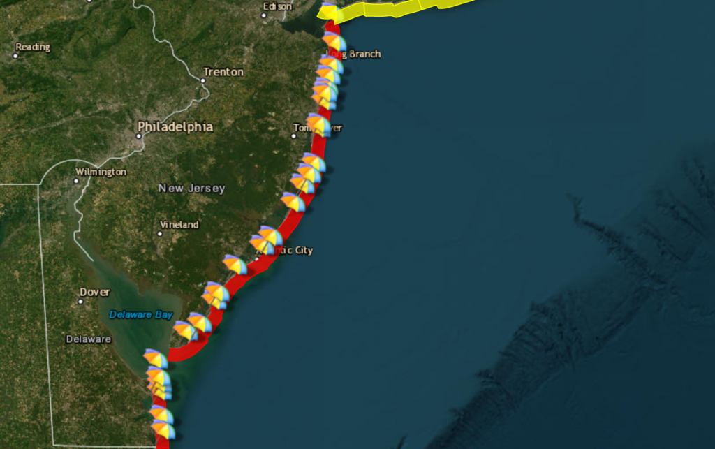
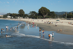
| The map below is color-coded to indicate the forecast rip current risk level. Click on the beach area of your choice for more information, or click a beach umbrella for the detailed, beach forecast.View the product description document for more information on the rip current graphic. Comments are currently being accepted. |
| National Weather Service Philadelphia-Mt Holly RIP CURRENT RISK for 5/22/2026 Valid as of 401 PM EDTEXPERIMENTAL | Out |
| Risk Level | Description |
|---|---|
| Low | The risk of rip currents is low, however, life threatening rip currents may still occur especially near groins, jetties, reefs, and piers. Always swim near a lifeguard and remember to heed the advice of the local beach patrol and flag warning systems. |
| Moderate | Life threatening rip currents are possible. Always swim near a lifeguard and remember to heed the advice of the local beach patrol and flag warning systems. |
| High | Life threatening rip currents are likely. The surf zone is dangerous for all levels of swimmers. Stay out of the water. Remember to heed the advice of the local beach patrol and flag warning systems. |
| The Danger of Rip Currents Rip currents are powerful, channeled currents of water flowing away from shore. They typically extend from the shoreline, through the surf zone, and past the line of breaking waves. Rip currents can occur at any beach with breaking waves.En EspanolIf you become caught in a rip current, yell for help and remain calm. Do not exhaust yourself and stay afloat while waiting for help. If you have to swim out of a rip current, swim parallel to shore and back toward the beach when possible. Do not attempt to swim directly against a rip current as you will tire quickly.Never assume the ocean is safe, even if the weather is nice. Hurricanes that are far away can still create deadly rip currents and waves. For maximum safety, swim near a lifeguard. | |
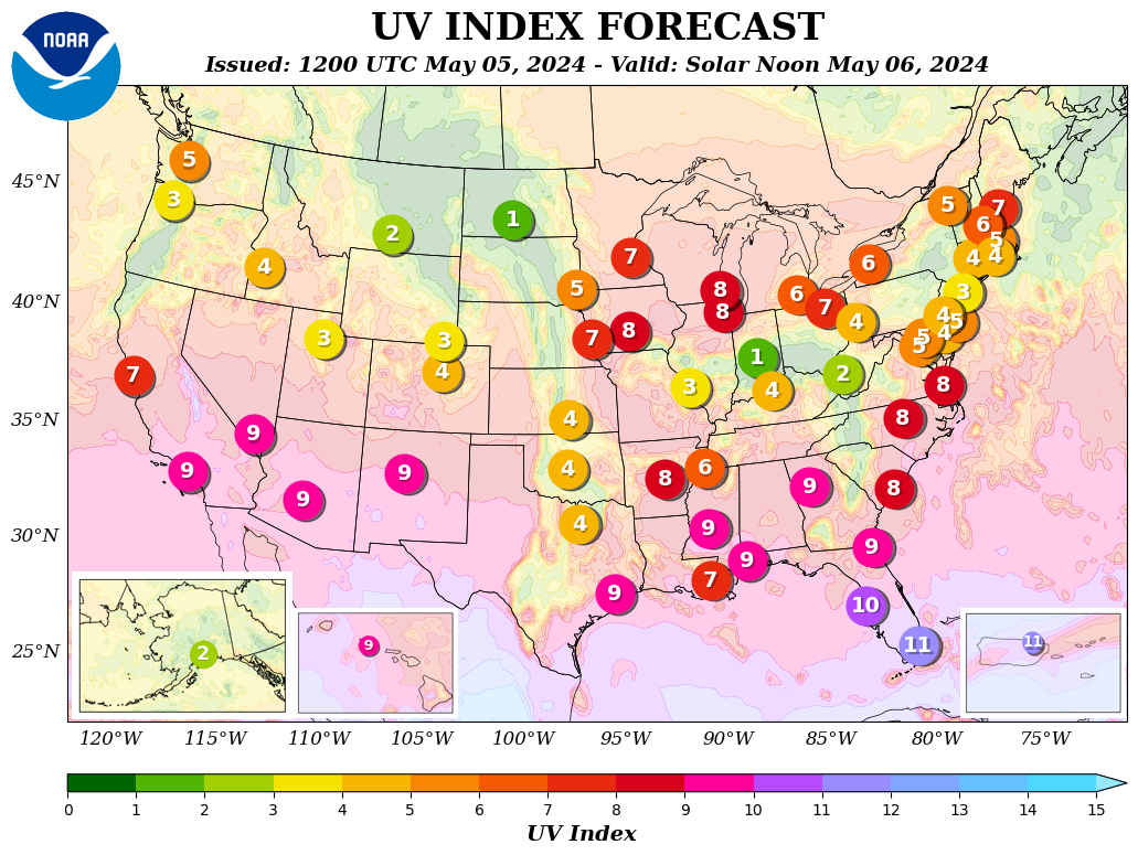
| Additional ResourcesUV Index Scale2 or lessLowLow danger from the sun’s UV rays for the average person.Wear sunglasses on bright days. If you burn easily, cover up and use sunscreen.3 – 5ModerateModerate risk of harm from unprotected sun exposure.Take precautions, such as covering up, if you will be outside. Stay in shade near midday when the sun is strongest.6 – 7HighHigh risk of harm from unprotected sun exposure.Protection against sunburn is needed. Reduce time in the sun between 10 a.m. and 4 p.m. Cover up, wear a hat and sunglasses, and use sunscreen.8 – 10Very HighVery high risk of harm from unprotected sun exposure.Take extra precautions. Unprotected skin will be damaged and can burn quickly. Minimize sun exposure between 10 a.m. and 4 p.m. Otherwise, seek shade, cover up, wear a hat and sunglasses, and use sunscreen.11+ExtremeExtreme risk of harm from unprotected sun exposure.Take all precautions. Unprotected skin can burn in minutes. Beachgoers should know that white sand and other bright surfaces reflect UV and will increase UV exposure. Try to avoid sun exposure between 10 a.m. and 4 p.m. Seek shade, cover up, wear a hat and sunglasses, and use sunscreen. Thunderstorm Potential (definition)Waterspout Risk (definition)NoneNo thunderstorms are expectedNoneNo risk of waterspout developmentLowThunderstorms are only expected to be isolated in coverageLowLow risk of waterspout developmentModerateThunderstorms are forecast to be scattered in coverageModerateModerate risk of waterspout developmentHighThunderstorms are forecast to be numerous or widespread in coverageHighHigh risk of waterspout development. | |
Weather Hazard Information
Air Quality

▪ Forecast Information
▪ Safety Information
▪ Materials For Use
Beach Hazards

▪ Forecast Information
▪ Safety Information
▪ Materials For Use
Heat

▪ Forecast Information
▪ Safety Information
▪ Materials For Use
Hurricanes

▪ Forecast Information
▪ Safety Information
▪ Materials For Use
Lightning
▪ Forecast Information
▪ Safety Information
▪ Materials For Use
Rip Currents
▪ Forecast Information
▪ Safety Information
▪ Materials For Use
Thunderstorms
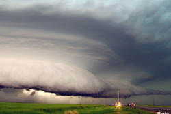
▪ Forecast Information
▪ Safety Information
▪ Materials For Use
Tornado
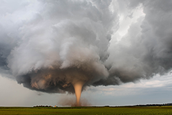
▪ Forecast Information
▪ Safety Information
▪ Materials For Use
Tsunamis
▪ Forecast Information
▪ Safety Information
▪ Materials For Use
Wildfire
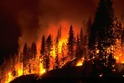
▪ Forecast Information
▪ Safety Information
▪ Materials For Use
Wind

▪ Forecast Information
▪ Safety Information
▪ Materials For Use
SOURCE NATIONAL WEATHER SERVICE