
Gloucester City’s Freedom Pier was unveiled 15 years ago, on September 17, 2011. Approximately 100 people attended the dedication ceremony, including State Senator Donald Norcross; Assemblymen Gilbert “Whip” Wilson and Angel Fuentes; Sheriff and former Mayor Charles Billingham; Freeholder and former City Councilman Tom Gurick; Councilmen Nick Marchese, Jay Brophy, and Dan Spencer; City Historian Dave Munn; School Board President Louisa Llewellyn; and St. Mary’s Church Deacon Frank Crosson.

For over five decades Cleary’s Notebook News has written about the Gloucester City’s waterfront and the many redevelopment plans that promised transformation but ultimately fell short. The first plan presented to the City Fathers came from a North Jersey developer in 1987. He envisioned Hollywood East being built along the City’s waterfront. Mayor and council would not commit to the proposal until the develolper released his financial documents. The developer refused to provide that information until he was named the project developer.
That was followed by the King Street Corridor plan. In anticipation of that proposal the City purchased the corner bar at King and Cumberland Streets and demolished it. They also demolished the former King Theater. Those in charge announced the space were the bar and the theater were would be used for development plan. But that idea never got any further than the architect drawings.
Since then, a litany of proposistions have been announced with great fanfare, only to stall, collapse, or become entangled in lawsuits and political disputes. Those sketches ended up with all the other plans in the attic of the municipal building.
(See a list of those gradiose plans below)
The lingering question remains: Why have neighboring communities such as Brooklawn, Bellmawr, Camden City, and Deptford Township been able to move forward with successful redevelopment projects while Gloucester City continues to struggle to turn vision into reality?
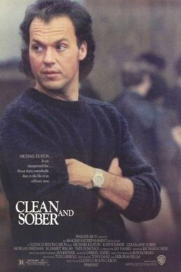
Editor’s Note: In 1988 a year after the Hollywood East developer was talking with mayor and council an excerpt of a Hollywood movie was filmed in the 300 block of Morris Street. According to Wikipedia, Clean and Sober is a 1988 American drama starring Michael Keaton as a a drug addict trying to give up drugs. This film was Keaton’s first dramatic departure from comedies. The supporting cast includes Kathy Baker, M. Emmet Walsh, Morgan Freeman, Luca Bercovici and Tate Donovan. The film received strong acclaim, but was a box-office flop. Ron Howard, who directed Keaton in the comedies Night Shift and Gung Ho, was co-producer.
*****
Fifteen years after the dedication of Freedom Pier, the waterfront remains less a symbol of accomplishment than a reminder of unfulfilled promises. And, 56 years after the first waterfront proposal was received those who have governed this City over that period have continued to waste money and time on unnecessary and questionable projects: the only guarantees they have lived up to are higher taxes and bureaucratic boondoggling.
Just yards from Freedom Pier stands a four-story white building that ultimately became the centerpiece of the site’s redevelopment efforts. Today, that building is being leased by the Holt family. The building sits on approximately two-acres of ground.
A month before the November 2006 Election, the incumbent mayor and council members seeking re-election announced that a well known builder had agreed to build 200 apartments on the pier. They stated, “Preliminary site work will be starting in the next month with heavy construction expected to start by the Fall of 2007. “
No one was surprised that the development of the city’s water front was being used in the campaign by the incumbents. What was a surprise is that those running blamed the previous failures for not developing the pier on prior mayor’s and council, all Democrats. The fight was between the Regular Democrats (Incumbent Mayor Tom Kilcourse, incumbent council members Elsie Loebell, Rocky Kormann). Those opposing them included, Independent Democrats (Mayor candidate Bill James, council candidates Nick Marchese and Jay Brophy).
The incumbents also announced their plans for the abandoned industrial area named Southport. That proposal resulted in the incumbents using $5 million borrowed from the Freeholder Board to buy AMSPEC/Harshaw Chemical on Water Street which bordered the waterfront. The incumbents called it Gloucester Vista. Those individuals promised if they were re-elected construction would start within a year. The plans called for a boat marina, a hotel, shops, restaurants and 300 condo’s. They also promised a seafood restaurant on the spot were Dooley’s Bar once occupied. Mayor Kilcourse, and his running mates, Councilman Kormann, and Councilwoman Elsie Loebell, never mentioned that the full council approved the purchased of that property for $450,000 . The $5 million spent to buy AMSPEC wasn’t mentioned either.
The Independent Democrats won the election. Once in office they learned that Southport was so contamidated it would take at least 10 years maybe longer to remove all the hazardous chemicals. Scarborough walked away from building anything on Freedom Pier. The taxpayers also learned that they would be floating a $5 million bond to pay back the money borrowed from the Camden County Commissioners. As for the promise that a seafood restaurant would be built on the Dooley’s property, that too was not true.
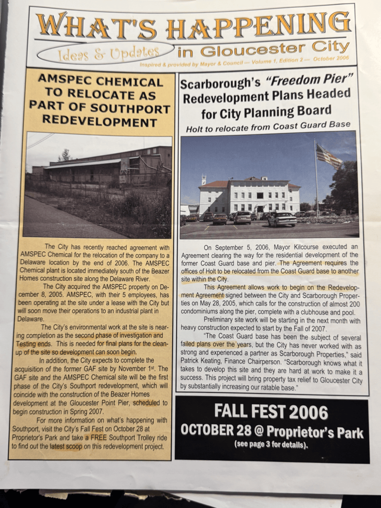
In 2006 local politics got involved in the development of the City’s waterfront.
OTTS ON THE WATERFRONT ANNOUNCED IN 2011
In 2011, another opportunity emerged when Ott’s Restaurant owner Donald Bigley proposed building “Ott’s on the Waterfront” on Freedom Pier. The project envisioned a two-story restaurant and bar featuring outdoor seating along the Delaware River. However, Bigley’s death on July 8, 2015, at age 65 brought the proposal to an end. His sons later opened Ott’s Voorhees Tavern in the former Friendly’s restaurant near the Ritz Center on Haddonfield-Berlin Road.
Six-Story Senior Care Facility Proposed
In June 2019, the City received an offer from Commerce Pursuit Capital, L.P. to purchase approximately 2.5 acres of the undeveloped property. The company proposed a six-story senior care facility on the southern portion of the site. Although an agreement of sale was executed on June 17, 2019, the company ultimately terminated the deal during its due diligence period.
MERIDIA OFFERS TO BUILD 364 APARTMENTS
The following year, in 2020, Meridia proposed a more ambitious redevelopment plan featuring two mixed-use buildings, residential units, commercial space, and a waterfront restaurant. The project received site plan approval in August 2023.
Almost immediately, legal challenges followed.
On September 1, 2023, Holt and Cresmont filed a complaint in lieu of prerogative writ challenging Ordinance #20-2023. A second complaint was filed against the Planning Board and Meridia, challenging the site plan approval.
DEVELOPER NAMED FOR FREEDOM PIER
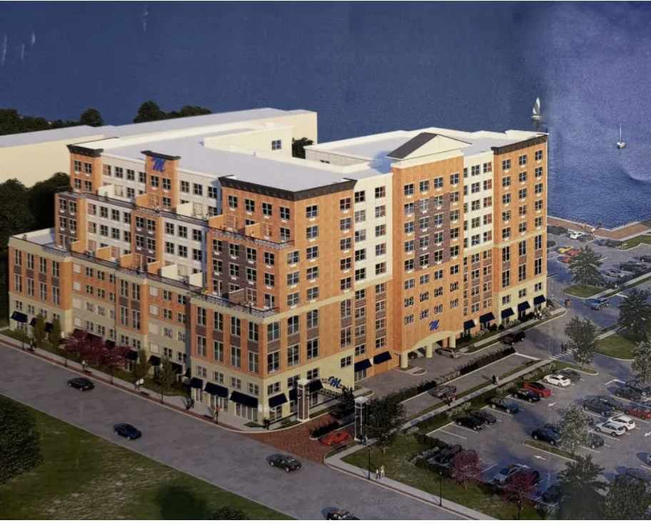
courtesy of Rt.42 Freeway-
Above is a depiction of what the apartment building facing King Street would look like. It’s location would be closer to King Street
According to Mark Mattews, editor of https://42freeway.com/, the Gloucester City Planning Board approved the construction of the Meridia Freedom Pier apartments at their February meeting. Matthews was a former reporter for Cleary’s Notebook News. The project was approved for Freedom Pier and the adjacent property that fronts King Street. One building will be developed on the outcropped Freedom Pier, while the second will be constructed on the mainland portion of the property immediately adjacent to King Street. The total number of apartments to be constructed is 364.
The project is being developed by Capodagli Property Company through its Meridia subsidiary.
During public hearings, Holt representatives argued that the proposal overdevelops the site and fails to maximize its public waterfront potential. They contended that developing “every square inch” of the property is inconsistent with the unique character and opportunities afforded by the riverfront location.
RELATED:
The Holt Files: Part One The Holt Family Arrives in Gloucester City
THE HOLT FILES: From a 1981 Wetlands Violation
Holt’s Third Try to Stop Gloucester City’s Development Plans
The Heavy Cost of Holt’s Gloucester City Shipping Hub
26 Development plans presented over the years to the public are listed below:
- Coast Guard Redevelopment Plan Map – March 1996
- Coast Guard Redevelopment Plan – March 1996
- Res 091 1996 Coast Guard Base Redevelopment
- Pine Grove Multi-site Project Area Redevelopment Plan – January 2005
- Pine Grove Redevelopment Plan Map
- Res 047 2005 Pine Grove Redevelopment
- North Burlington Street Redevelopment Plan – May 2001
- North Burlington Street Redevelopment Plan Map
- Res 126 2001 North Burlington St Redevelopment
- North King Street Redevelopment Plan – October 1996
- North King Street Redevelopment Map
- Res 041 1996 N King Street Redevelopment
- Ord 028 1996 North King Street Redevelopment
- Mercer Street (222) & Hudson Street (323) Redevelopment Plans – March 1998
- Mercer Street Redevelopment Map
- Res 113 1998 Hudson Street Redevelopment
- Res 114 1998 Mercer Street Redevelopment
- Sixth Street Redevelopment Plan – June 1996
- Sixth Street Redevelopment Map
- Res 158 1996 Sixth St Redevelopment
- West Market Street Redevelopment Plan – March 1998
- West Market Street Redevelopment Plan Map
- Res 115 1998 West Market Street
- South Broadway Redevelopment Plan – July 1998
- South Broadway Redevelopment Map
- Res 210 1998 South Broadway Redevelopment
- Southport Redevelopment Plan – August 2004
- Southport Redevelopment Map
- Res 149 2005 South Port Redevelopment 2004
- Southport Redevelopment Plan – March 2006 – Section 1
- Southport Redevelopment Plan – Section 2
- Southport Redevelopment Plan – Section 3
- Southport Redevelopment Map
- Ordinance Amending Redevelopment Plan – #013-2010
- West Market Street Redevelopment Plan – June 2003 – Section 1
- West Market Street Redevelopment Plan – Section 2
- West Market Street Redevelopment Map – 2003
- Redevelopment Study for Block 256 Lots 1 and 1.01 – February 2008
- Redevelopment Study for Block 256 Lots 1 and 1.01 Plan Map
- Resolution 101 2008 Redevelopment
Source of plans City of Gloucester City